- City and Installation Guide
- City Listings (new)
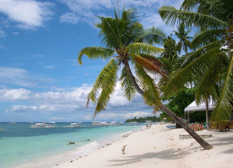
- Panglao Island
Panglao Island
Geographical Address

The island has an area of 91.12 square kilometres (35.18 sq mi). It is within Bohol Province, and comprises two municipalities: Dauis and Panglao. Panglao island is located southwest of the island of Bohol and east and south of Cebu.
Panglao has a terrain that ranges from plain, hilly to mountainous. Panglao is made of Maribojoc limestone, the youngest of the limestone units found in the western area of Bohol. The limestone composition halted the development of an airport as coralline limestone is soluble which causes formation of caves and sinkholes. One interesting geological feature found in the island is the Hinagdanan Cave which has an underground water source. The cave is an important water source as the island has no rivers or lakes.
Panglao is a popular tourist destination in the Philippines, and includes several small islands, such as Gak-ang, Pontod, and Balicasag.
According to the 2015 census, it has a population of 79,216.
Panglao was known to Chinese, Malay, Siamese and Indonesian traders. It once housed the Kedatuan of Dapitan.
https://en.wikipedia.org/wiki/Panglao_Island

Map
-
{{#owner}}
-
{{#url}}
{{#avatarSrc}}
{{name}} {{/url}} {{^url}} {{#avatar}} {{& avatar}} {{/avatar}} {{name}} {{/url}} - {{/owner}} {{#created}}
- {{created}} {{/created}}
