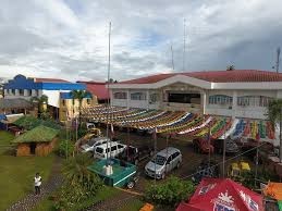
Cabatuan
Geographical Address

Cabatuan, officially the Municipality of Cabatuan, is a 3rd class municipality in the province of Isabela, Philippines. According to the 2015 census, it has a population of 39,413 people.[3]
Cabatuan occupies a land area of 7,200 hectares. It lies in the south-western part of the Province of Isabela bounded on the north by the Municipality of Aurora, on the east by the Municipality of Luna, on the west by the Municipality of San Mateo and on the south by the Municipality of Cauayan. Its territorial boundaries are more specifically delineated under Executive Order 293 issued by President Elpidio Quirino on November 5, 1949.
Being a major rice producing town, it is the home of several rice mills and rice traders, dubbed as the Land of the Golden Grains.
https://en.wikipedia.org/wiki/Cabatuan,_Isabela
Map
-
{{#owner}}
-
{{#url}}
{{#avatarSrc}}
{{name}} {{/url}} {{^url}} {{#avatar}} {{& avatar}} {{/avatar}} {{name}} {{/url}} - {{/owner}} {{#created}}
- {{created}} {{/created}}


