- City and Installation Guide
- City Listings (new)
- Mangatarem
Mangatarem
E
elie
Updated
Geographical Address
Country
Province
City
Postal Code
2413
latitude
15.76
longitude
120.3
Area
317.50 km2
Founded
1837
Division
Luzon
Region
Region 1

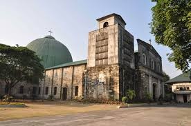
Mangatarem, officially the Municipality of Mangatarem, (Pangasinan: Baley na Mangatarem; Ilokano: Ili ti Mangatarem; Tagalog: Bayan ng Mangatarem), is a 1st class municipality in the province of Pangasinan, Philippines. According to the 2015 census, it has a population of 73,241 people.[3]
Mangatarem Town Hall
Mangatarem is a Pangasinan word for "mango plantation". The town's name also came from the Ilocano Phrase which means "mango and oyster".[6]
The municipality is home to the Manleluag Spring Protected Landscape.
https://en.wikipedia.org/wiki/Mangatarem,_Pangasinan

Map
{{#ratings}}
{{title}}
{{#ownerCreatedBlock}}
{{/ownerCreatedBlock}}
{{#category}}
{{#editor}}
{{/editor}}
{{#user}}
{{/user}}
{{/ratings}}
-
{{#owner}}
-
{{#url}}
{{#avatarSrc}}
{{name}} {{/url}} {{^url}} {{#avatar}} {{& avatar}} {{/avatar}} {{name}} {{/url}} - {{/owner}} {{#created}}
- {{created}} {{/created}}
Category: {{category.title}}
{{/category}}
{{#fields}}
{{#showLabel}}
{{/fields}}
{{label}}:
{{/showLabel}}
{{& text}}
