- City and Installation Guide
- City Listings (new)
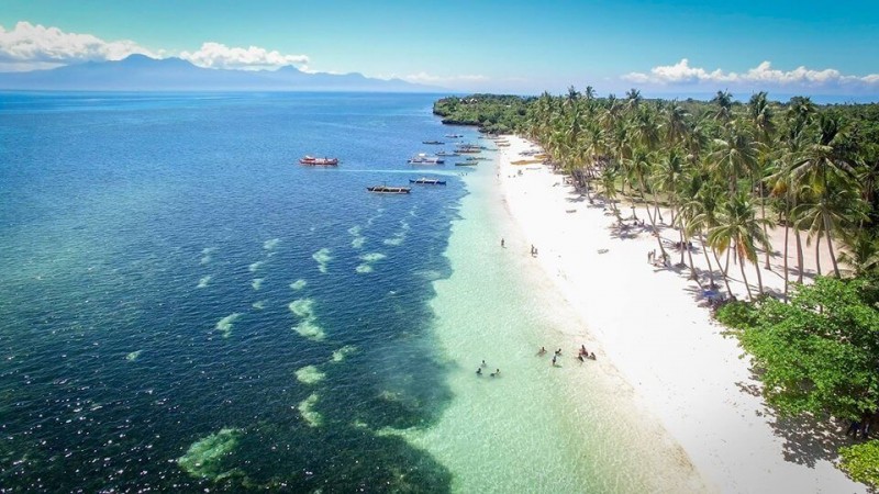
- Siquijor Island
Siquijor Island
E
elie
Updated
Geographical Address
Country
Province
City
Postal Code
6225
latitude
9.2
longitude
123.6
Area
343.5 km²
Division
Central Visayas
Region
VII

Siquijor /ˈsɪkiːhɔː/ (Cebuano: Lalawigan sa Siquijor, Filipino: Lalawigan ng Siquijor) is a 5th provincial income class island province of the Philippines located in the Central Visayas region. Its capital is the municipality also named Siquijor. To the north of Siquijor is Cebu, to the west is Negros, northeast is Bohol, and to the south, across the Bohol Sea, is Mindanao.
During the Spanish colonial period of the Philippines, the Spaniards called the island Isla del Fuego (Island of Fire). Siquijor is commonly associated with mystic traditions that the island's growing tourism industry capitalizes on.
https://en.wikipedia.org/wiki/Siquijor

Map
{{#ratings}}
{{title}}
{{#ownerCreatedBlock}}
{{/ownerCreatedBlock}}
{{#category}}
{{#editor}}
{{/editor}}
{{#user}}
{{/user}}
{{/ratings}}
-
{{#owner}}
-
{{#url}}
{{#avatarSrc}}
{{name}} {{/url}} {{^url}} {{#avatar}} {{& avatar}} {{/avatar}} {{name}} {{/url}} - {{/owner}} {{#created}}
- {{created}} {{/created}}
Category: {{category.title}}
{{/category}}
{{#fields}}
{{#showLabel}}
{{/fields}}
{{label}}:
{{/showLabel}}
{{& text}}
