Introduction
The South Yuba River State Park extends more than 22 miles along the river from Point Defiance on Lake Engelbright toward the town of Washington. It contains numerous cultural history sites.
These include the Bridgeport Covered Bridge and Ranch, the Kneebone Pleasure Resort site, and the Independence Trail.
Introduction
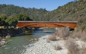
This historic barn, an example of the classic Dutch style, was built in the early 1860s, shortly before or after the present covered bridge was built in 1862. In addition to this coincidence of dates, the barn's close association with the bridge is witnessed by its orientation, with its two main doors forming a line pointing directly at the bridge, as shown in the photo above. This was done because the barn was built to serve as a "filling station" in addition to being the multi-purpose barn for the 160-acre Thompson (and later, Cole) ranch (it was subsequently used by the Kneebone family, but that's another story). Wagons with large teams of horses could drive into the barn from either end (going to or coming from the bridge), take on fresh hay and grain, rest the horses and teamsters and be repaired if needed, and then continue on their way with no need for turning.
The barn served several functions: animal stalls and pens, hay storage in the loft, storage of farm equipment, and service of wagons passing through on the Virginia Turnpike on their way to Sierra mines and the Nevada Territory. In time, modifications and additions were made as needed, such as small living quarters for a hired hand on the east side.
By 1927 the barn served primarily for storage, and in 1966 the word "Ponderosa" was painted on the south face and east roof slope as an advertisement for the Bridgeport-Ponderosa Corp., a short-lived attempt to revive the resort operated by Alfred Kneebone from 1927 to1930.
In 1972 Nevada County acquired two acres of land including the barn, which property eventually became part of the present State Park.
The barn was repainted in 1997. In 2000 the metal roof and "Ponderosa" sign were replaced with shingles as originally designed.
BRIDGEPORT HISTORY
Introduction
Soon after the construction of the 1850 bridges across the South and Main Yuba River branches, near their confluence, and the 1851 Sparks Bridge across the South Yuba, this district has been known as Bridgeport. A large part of the history of South Yuba River State Park is concentrated in Bridgeport. This history is summarized here, and described in detail on the Cultural History page.
COVERED BRIDGE HISTORY
Introduction
Rain began to fall in November 1861, and the South Yuba was 26 feet above low water on December 9. David Wood´s bridge at Bridgeport (the 1851 Sparks Bridge) and his bridge at Point Defiance washed away on January 4, 1862, By the end of January 1862, most bridges on the Yuba River were carried away, and 115 inches of rain had fallen in just three months. Damage was not limited to the Yuba watershed; storms also damaged bridges in Oregon in early 1862. David Wood was left without river crossings. Fortunately, he had leased and then bought a sawmill at Forest City in 1858. As soon as a new bridge design had been selected, he quickly set the mill to producing douglas fir timbers for the structural members and sugar pine shingles for the roof and siding for a new bridge.
Plants and Animals
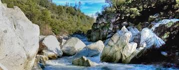
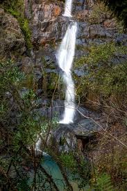
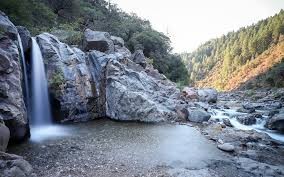
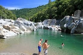
The South Yuba River State Park supports an intricate web of plant and animal life, from the plants that line the shore, to the wildflowers that cover the hillsides, to the insects, fish, amphibians, birds, and mammals that call this place their home. Designated as “Wild and Scenic”, the South Yuba River has been saved from several proposed dams, preserving both the riparian ecosystem and its scenic beauty.