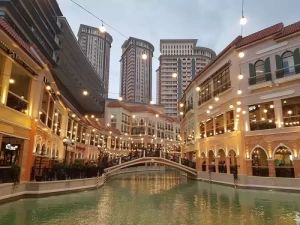
Taguig
Geographical Address
![]()
Taguig (Tagalog: Tagíg, pronounced [taˈɡiɡ], officially the City of Taguig, Filipino: Lungsod ng Tagíg) is a highly urbanized city located in the south-eastern portion of Metro Manila in the Philippines. From being a thriving fishing community along the shores of Laguna de Bay, it is now an important residential, commercial and industrial center. According to the 2015 census, Taguig is the seventh-most populous city in the Philippines, after Zamboanga City; it has a population of 804,915.[4]
The local government of Taguig currently administers Bonifacio Global City, which is considered as one of Metro Manila's central business districts alongside Makati CBD and Ortigas Center. Other future developments in the city include Arca South (formerly known as Food Terminal Incorporated) Ayala Land's 70-hectare business and lifestyle district,[5] and Laguna de Bay Lakeshore Development along the Bulacan–Rizal–Manila–Cavite Regional Expressway (C-6 Road).[6]
Taguig lies on the western shore of Laguna de Bay and is bordered by Muntinlupa to the south, Parañaque to the southwest, Pasayto the west, Cainta and Taytay on the northeast and Makati, Pateros, and Pasig to the north. The Taguig River, a tributary of the Pasig River, cuts through the northern half of the municipality and Napindan River, also a tributary of the Pasig forms the common border of Taguig with Pasig.
Map
-
{{#owner}}
-
{{#url}}
{{#avatarSrc}}
{{name}} {{/url}} {{^url}} {{#avatar}} {{& avatar}} {{/avatar}} {{name}} {{/url}} - {{/owner}} {{#created}}
- {{created}} {{/created}}


